Wisconsin corporate, commercial and editorial photographer. One of my goals for 2019 was to buy my first drone, get my FAA Part 107 license to fly the drone commercially and start incorporating the drone into the work I do for my clients and my stock photography. The FAA license isn’t about how to fly a drone, but rather how to fly one safely while understanding the restrictions in various types of air space controlled by the FAA. I’ve been shooting aerials from planes and helicopters since my way back days of interning at various newspapers as a photographer in the mid ‘80s. One of my frustrations with shooting from a helicopter or plane was we could never get low enough. Legally, you can’t fly a plane or helicopter less than a thousand feet above the ground. With a drone, however, the maximum height you’re allowed to fly is 400 feet above ground level and if you’re in controlled airspace, you may need to fly even less than that. The airspace in Green Bay has many areas with flight restrictions; there are also some no fly zones, like Lambeau Field and the area around the airport. Even if you want to fly a drone for business or recreational purposes outside of the no-fly zone by the airport, you still need to request permission from the FAA if you are within a 5 mile radius. My own home is in restricted airspace so any time I want to just pop the drone in the air, I need to get permission from the FAA. Luckily, the FAA has made it much easier to access permission though an app I have on my phone. Once I apply, I usually hear back within a few minutes if the permission has been granted,
I took a couple of classes, watched a bazillion online videos, and did multiple online sample tests to prepare for the FAA 107 license. When it came time to take the test, I’m happy to say I passed with a 91%. I haven’t heard of too many people scoring higher than that and maybe only one or two people who got a perfect score. Every two years you have to retake the test in order to renew your license. Let’s hope I can pull off a passing score again.
Making images with a drone isn’t without its challenges, but the different perspectives it gives makes it all worth while. I love it for my agriculture work, since it allows angles I could only get before by hiring a fixed wing plane or helicopter for hundred of dollars per hour. With the drone, I can set up my takeoff and landing site close to the area in which I’ll be photographing; this allows quick and efficient movement to get diverse shots from different perspectives. Let’s say I was shooting a tractor planting or harvesting in a field. If I were shooting still photos from the ground, I would shoot some long lens shots of the machinery coming at me, as well as a more medium telephoto, and then wide angle as the subject came towards me. But I would be somewhat limited in my angle. I’d also need to wait for the tractor to come back around for a second swipe if I wanted to shoot more. With the drone, I can easily move around the field to get different backgrounds, lighting, and field patterns; I can also vary my height. Some people think every drone shot needs to be taken from as high as possible, but I love being able to shoot from just 20, 30, or 40 feet above and either behind or in front of the tractor. When I shoot the work in the field, I might add some height to capture interesting patterns in the field as well.
As I’ve become more confident in my skills, I’ve also been sending the drone out over the water to shoot anything from lighthouses to surfers. Just a few weeks ago, I stopped at one of my favorite spots on Lake Michigan to catch surfers and was rewarded with some very cool photos of the bright surfboard against the pattern of the waves. The ground level shots wouldn’t have been nearly as interesting; with the overcast sky and the surfer in a wet suit, there was not much differentiation in color between him and the water. Once winter sets in, I hope to get out to some lighthouses with ice accumulating on them. I’ve already talked to a commercial fisherman to get some drone shots as he busts his way out of a frozen river.
I’ve also become more comfortable in my skills to fly the drone indoors, and I just completed both still and video shots in a production facility in Illinois. The video shots I got as the drone flew down an aisle in a warehouse as forklifts picked items of shelves was very cool.
One of the biggest challenges in adding drone photography to my business was dealing with insurance. Many of the major insurance companies won’t insure you when you fly a drone commercially. If you buy one for you and your kids to fly around and take some shots of your house, you’re probably insured. But once you start getting something in exchange for the shots, you usually aren’t covered even with a normal business policy. I found a vendor that allows me to vary the amount of liability insurance I need for a specific shoot, with the upper limit being ten million dollars. It also allows me to buy insurance for just the duration of the shoot. If I’m flying the drone around a farmer’s field, I usually don’t need the same level of liability as I would if I’m flying my drone above a piece of machinery in a production line that would result in major problems if I crashed the drone into it.
It does get frustrating when I see shots that I know violate various FAA rules governing drone flight. One rule is that you have to maintain the drone in your visual line of sight at all times. You also can’t take off or land in a state or national park. So when I see a shot of a lighthouse inside of a state park from 50 feet off the light, and the terrain is such that I know it would be impossible to maintain a visual line of sight to the drone, it’s obviously a rule violation – even if you could fly to the location and back from your take off and landing spot outside the park. Or when I see shots of a building popping out of low level fog, I know the drone pilot violated maintaining a visual line of site with the drone because of the fog; also, you’re required to have 3 miles of visibility to fly, so there is another rule violated.
The FAA is continuously making changes to the rules for drones. Some of these rules will not only make it much harder for drone owners to fly their drones without having an FAA license, but it will also clamp down on both hobbyists and commercial pilots that are not flying within the rules. From what I’m reading, it won’t be long before all drones will need to have a transponder in them to let the FAA know to whom the drone is registered. Most drones built in the last few years have those transponders built in; they just need to be activated.
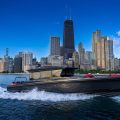
Below are some of my favorite drone shots from 2019. Special thanks to Bill Bongle of Titletown Drones and the wisdom he shared in the classes I took with him. He made sure I didn’t crash the drone I bought from him on my first flight. He also has been a great resource in answering technical or industry questions throughout the year.
If you’d like to see my best of 2018 blog please visit this link.
Thanks for looking!
Mike
.jpg)
.jpg)
.jpg)
.jpg)
.jpg)
.jpg)
.jpg)
.jpg)
.jpg)
.jpg)
.jpg)
.jpg)
.jpg)
.jpg)
.jpg)
.jpg)
.jpg)
.jpg)
.jpg)
.jpg)
.jpg)


